Flooded defensive water barrier on Gibraltar’s isthmus, restricting land approach.
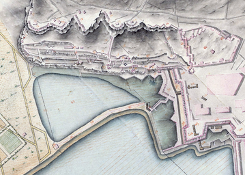
The Inundation was a flooded and fortified body of water on the sandy isthmus between Spain and Gibraltar. Created by the British in 1735 from a marshy area called the Morass, it obstructed land access to Gibraltar via a narrow causeway enfiladed by numerous batteries on the Rock.
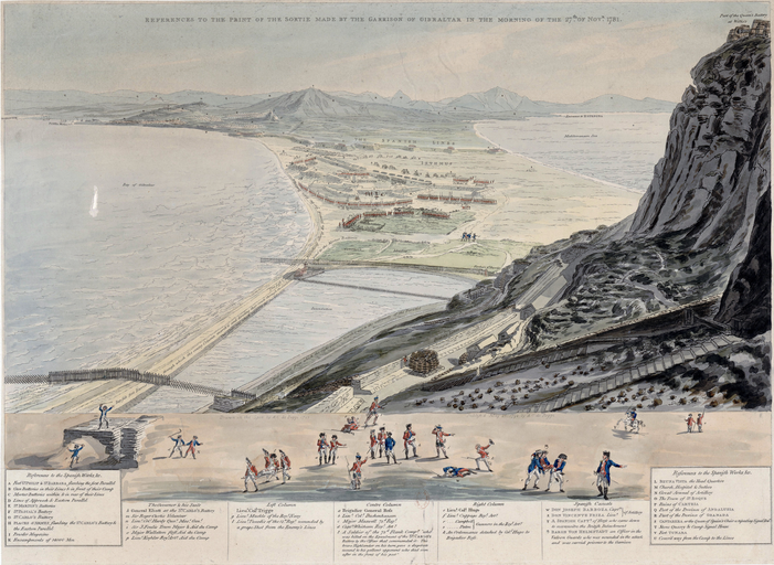
The Inundation, also known as La Laguna, was a flooded and fortified body of water forming part of the fortifications of Gibraltar. It occupied a former marshy area called the Morass at the far south‑western end of the sandy isthmus between Spain and Gibraltar, adjacent to the north‑western flank of the Rock of Gibraltar. In 1735 the Morass was dug out and flooded to create a pear‑shaped artificial lake connected to the sea by a short channel, initially controlled by a four‑foot‑high dike that allowed the five‑foot high tide to replenish it. An eighteenth‑century account described it as about 200 yards long, 60 yards broad and nearly man‑height in depth. The Inundation restricted landward access to two narrow passages, one below the cliff face and the other along a causeway, later Winston Churchill Avenue, between the sea and the Landport Gate. Defences included the Advance Guard Room, later Forbes’ Barrier, the Bayside Barrier, palisades, chevaux de frise, ditches, stakes, iron hoops and other obstacles in the water. The causeway and Inundation were covered by multiple batteries and lines on the Rock. The Inundation existed for about 200 years before being drained, infilled and built over after the Second World War.