Description
ベルリン近郊、ブランデンブルク州の展望塔がある丘。
Wehlabergは、ドイツのブランデンブルク州に位置する丘で、クラウスニッカー山地の最高地点です。標高144.1メートルで、頂上には展望塔があります。この塔からは、周囲の自然保護区や遠くのベルリンテレビ塔までの景色を楽しむことができます。
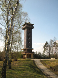
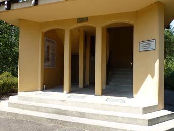
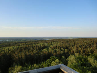
ヴェーラベルクは、ドイツのブランデンブルク州、ダーメ=シュプレーヴァルト郡に位置する丘で、クラウスニッカー山地の最高地点である。標高は144.1メートルで、シュプレーヴァルト生物圏保護区内に位置している。丘の頂上には展望塔があり、訪れる人々に広大な景色を提供している。この展望塔は2003年に建設され、高さは28メートルである。塔の下部は堅固な構造で、上部は部分的に木製で覆われている。訪問者はコンクリートの階段を使って約4メートルの高さにある覆われた下部プラットフォームにアクセスし、さらに木製の階段を使って上部の展望プラットフォームに到達することができる。ここからは、クラウスニッカー山地や北に広がるハイデゼーンを見渡すことができ、視界が良ければ、北北西に58キロメートル離れたベルリンのテレビ塔も見えることがある。ヴェーラベルクの南側にはヨーロッパ長距離歩道E10やキュウリ自転車道が通っており、ハイキングやサイクリングを楽しむ人々に人気のスポットとなっている。また、丘の東約600メートルには、携帯電話の送信塔と火災監視塔が設置されている。
Photos (3)
© Botaurus
·
Public Domain
© Muck
·
CC BY-SA 4.0
© Niesen
·
GNU Free Documentation License
Ratings
Fame:
30
Wow:
45
Ease of Access:
15
Physical Demand:
20
Safety:
10
Tourist Density:
35
Small hill with limited Wikipedia presence; primarily known locally within Brandenburg, Germany.
Offers panoramic views over the Spreewald and Köthener See; pleasant but not a jaw-dropping natural spectacle.
Located in rural Brandenburg, accessible by car or public transport from nearby towns like Köthen; standard tourist infrastructure available.
Easy walk to reach the observation tower with stairs leading up to viewing platforms; suitable for most visitors including families.
Germany is generally safe; this rural area has no significant natural or industrial hazards, low crime rate.
Local attraction with moderate footfall; popular among locals and some tourists but not a major international draw.
Location & Coordinates
52.058056, 13.801111